Survey, LIDAR Scanning, Subsurface Utility Engineering and More
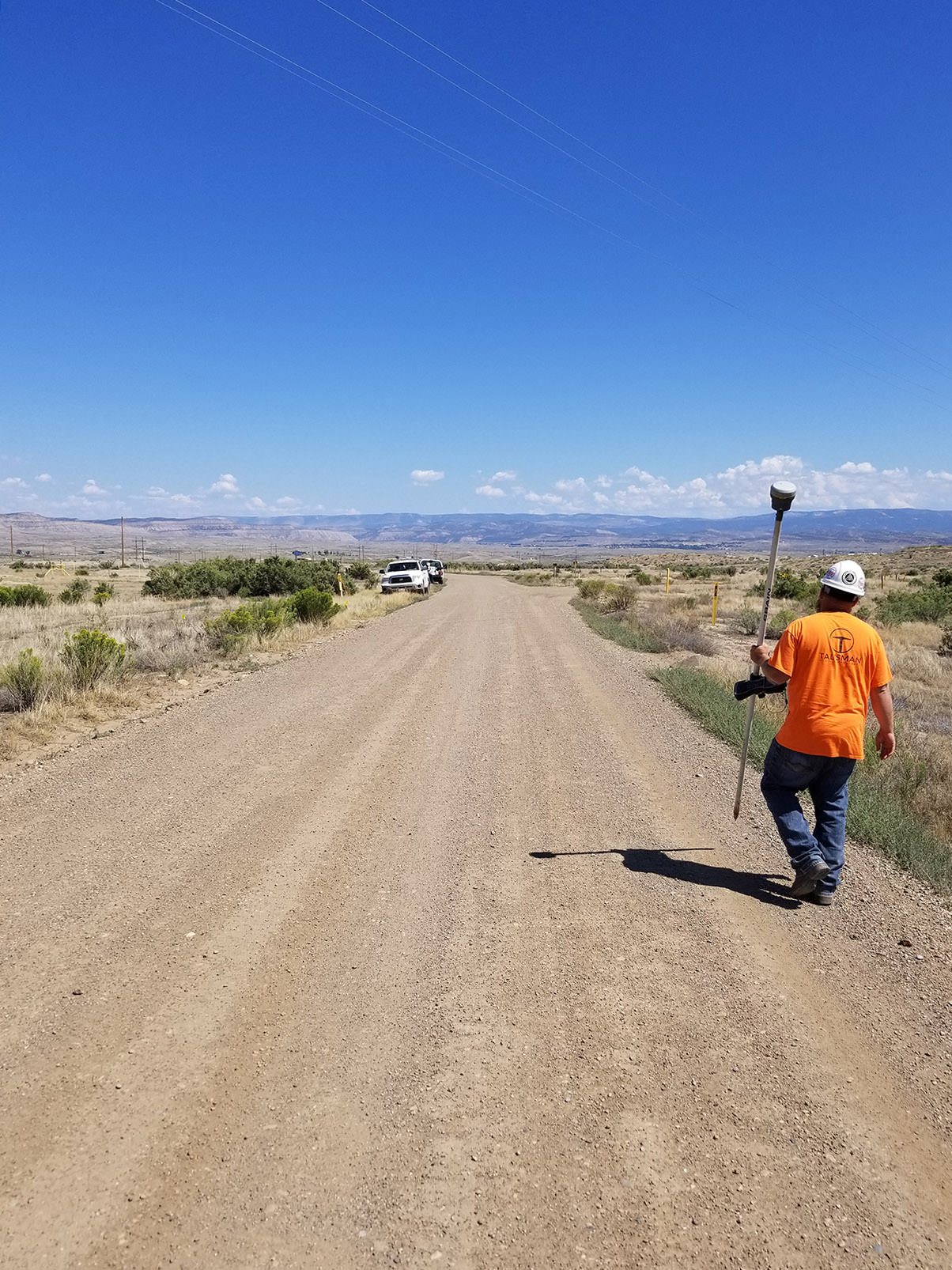
We specialize in surveying, scanning, right-of-way acquisition, and subsurface utility engineering (SUE) services across both urban and remote sites. Our projects range from single-site surveys and utility investigations to large-scale, multi-phase developments for residential, commercial, and public sector clients. By combining advanced surveying techniques with precise underground utility mapping, we provide comprehensive data to support efficient planning, design, and construction.
Registered Land Surveyors
Talisman Civil Consultants is a registered land surveyor in Utah, Colorado, and Nevada.
Key Land Surveying Services

Field
Surveying
We provide a full range of survey services using both traditional methods and modern technology to meet today’s standards for deliverables. Our expertise includes but is not limited to topographic mapping, construction staking, boundary and right-of-way surveys, ALTA/NSPS land title surveys, and easement documentation. At the core of our work is a commitment to building strong, long-term partnerships with our clients. This approach allows us to deliver timely and accurate survey data that supports critical project decisions and enhances overall site understanding during early project phases and beyond.

Subsurface Utility Engineering
Our SUE services provide precise identification and mapping of underground utilities to reduce project risks and prevent costly conflicts during construction. Using advanced technologies such as ground-penetrating radar (GPR) and electromagnetic locating, we deliver accurate utility data tailored to project needs. Our comprehensive approach includes utility research, field verification, and detailed mapping to support informed decision-making for design and construction teams. Whether for roadway projects, site developments, or infrastructure upgrades, our SUE expertise ensures safer, more efficient project execution.

Right-of-Way
Acquisition
Our Right of Way (ROW) services support successful project delivery by addressing both the legal and physical requirements needed for design and construction. We provide ROW research, mapping, and exhibit preparation, along with acquisition support services that help streamline coordination with property owners and agencies. Our work includes record and title research, parcel and easement identification, survey coordination, and support throughout the acquisition process to reduce risk and avoid delays. Whether for transportation corridors, utility projects, or site developments, our ROW expertise helps clients move projects forward with clarity, accuracy, and confidence.

Construction Staking
We offer both traditional and modern survey practices for today’s standard survey deliverables including topographic mapping, construction staking, boundary surveying, right-of-way surveying, ALTA surveys, and easements. We focus on developing strong, ongoing partnerships with each of our clients, helping to turn around survey assignments quickly to help with detailed site understanding needed for critical project decision making.

Orthographic Aerial Photography
We are also proud to offer LIDAR and HDS 3D Scanning technologies, and we employ these high-tech methods on nearly all of our surveys conducted today. It enables better decisions and provides information that is often unattainable via traditional survey methods. HDS reduces or eliminates rework since changes can be modeled on screen and fit within the existing conditions in a real-time virtual model. This methodology is especially valuable for the delivery of high-volume surveys.

LIDAR & HDS 3D Scanning
We offer advanced surveying technologies, including LiDAR and High-Definition Surveying (HDS) 3D scanning, which we incorporate into nearly all of our survey projects. These tools capture detailed spatial data that traditional methods often cannot, enabling better-informed decisions and more comprehensive site analysis. By modeling changes in a real-time virtual environment, HDS significantly reduces the risk of rework and helps ensure design compatibility with existing site conditions. This approach is especially effective for large-scale or high-volume survey efforts, where accuracy and efficiency are critical.
Complete List of Survey Services
Subsurface Utility Engineering (SUE) ALTA/ACSM Land Title Surveys
Topographic/Design
Surveys and Mapping
Utility Surveys
Route Surveys
Preparation of Legal Descriptions
Right-of-Way Surveys
Construction Staking Services including As-Built and Quantity Surveys
Hydrographic Surveys
Environmental Hazardous Waste Surveys
GPS Surveys
Expert Witness Testimony
GIS Data Collection
Photogrammetric Mapping – Digital
Boundary Surveys
Preparation and Processing fo Record Surveys, Corner Records, Parcel Maps, and Subdivision Maps and Plats
